 |
| GIS Training in Kathmandu Nepal |
Course details:
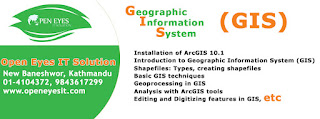
1. Installation of ArcGIS 10.1
2.Introduction to Geographic Information System (GIS)
3. Introduction to Geographic Information System(GIS)
4.Shapefiles: Types , Creatining Shapefiles
5.Basic GIS Techniques
6.Geoprocessing in GIS
7. Analysis with ArcGIS Tools
Building queries, selecting features in a set of features, shapefiles Based on location and / or Attributes
8. Editing and digitizing in features in GIS
9. Use if Arcscan tool to digitize Scanned maps
10.Georeferencing
11. 3-D Analysis in GIS
12. Simple Analysis Using GIS
13.Hydrological Analysis using GIS
14.Spatial Analysis
15. Data interoperability
1. Installation of ArcGIS 10.1
2.Introduction to Geographic Information System (GIS)
- General Overview of Geographic Information System
- General Overview of Primary Components of Geographic information System
- GIS Data types: Vector and Raster
 |
| GIS Training in Kathmandu Nepal |
- Overview of the user interface/working environment of ArcCatalog
- Overview of the user interface/working environment of ArcMap and ArcScence
- General Map
- General Map Analysis
4.Shapefiles: Types , Creatining Shapefiles
5.Basic GIS Techniques
- Viewing data,classfying features
- Introduction to tables, working with tables
- Changing the table display editing values and adding fields
- Joining tables, Linking tables,Summerizing
- Layer symbology, Labeling
6.Geoprocessing in GIS
7. Analysis with ArcGIS Tools
Building queries, selecting features in a set of features, shapefiles Based on location and / or Attributes
- working in layout view
- Printing maps
 |
| GIS Training in Kathmandu Nepal |
- Editing Features
- Digitizing Scanned maps
- Working with attributes tables
- Exporting data to MSExcel
- Making a topographical map
9. Use if Arcscan tool to digitize Scanned maps
10.Georeferencing
- GeneralConcept of georeferencing
- Geo Referencing of Scanned maps to a set of known coordinate points
11. 3-D Analysis in GIS
- Introduction to DEM, TIN Surface
- General concept of 3D Analysis
- ArcMap tools for 3D Analysis
- Exercise on 3D Analysis
12. Simple Analysis Using GIS
 |
| GIS Training in Kathmandu Nepal |
- Use of hydrology toolbar
- Watershed Delineation
- Area and volume of Reservoirs
14.Spatial Analysis
- Use of Model Builder
15. Data interoperability
- Importing /Exporting Data to and from different sources/formats
No comments:
Post a Comment