 |
| GIS Training in Kathmandu Nepal |
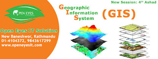
This program in Geographic Information Systems & Remote Sensing has become main technological tool for the collections, storages & examination of spatially referenced data. Industries utilizing these spatial technology which includes agriculture, forestry, mining, market research, environmental examination as well as the social & medical science.
This program also permits students to improve their knowledge & practical proficiency in GIS & RS technologies & applications.
 |
| GIS Training in Kathmandu Nepal |
The program content includes the subjects, which offers significant flexibility that allows students to speedily profit the GIS & RS knowledge & qualifications they need today, & to add to their qualifications at a later date if needed. Students develop ability for independently research, problems study & solutions.
Student will develops their skill & understanding through formal course works. By problem solving, examination & research skill improve by examination and the conclusion of a literature reviews.
For this program the least qualification necessary is that student should be a science graduate, PG from MSc with geography, geology, agriculture, forestry, Engineers in all stream.
Program content includes:
1) Principle of GIS
Under this unit all the required topics of Geographic Information Systems is covered. Students increase the fundamental theory, technical & analytical skill essential to apply Geographic Information Systems to simply spatial problem. The subject includes a important elements of practical works in which student are optimistic to directly apply their theoretical knowledge. Concentration is focused on the operation of Geographic Information Systems & the applications of Geographic Information Systems to easy spatial analysis. This subject form a basis for further study in other modules.
 |
| GIS Training in Kathmandu Nepal |
2) Images Analysis
The subject covers the theoretical background of remote sensing; treats in detail the acquisition of digital data by imaging/non-imaging systems; and examines the commonly used procedures for enhancing and classifying multi spectral data.
3) GIS Application
This subject extends the study of Geographic Information Systems. It expands advanced knowledge in the complex modeling of spatial data. Subject modules includes:
1. SQL base spatial queries
2. Selected advance analysis
3. Rasters analysis
The subjects extend the student theory & analytical capability. The practical constituent forms an essential part in developing the essential skills in GIS modeling.
4) Cartography and Data Visualization
This topic introduces the student to the methods for the arrangement of spatial, numerical and table based data in order to maximize their efficiency and make simpler their understanding. Students will learn, geo coding, designing visualisation of informations, problems of human perception, variations in audience type, and the media or presentation environment selected.
5) Integrated Remote Sensing and GIS
This topic focuses on the integrations of geographic information systems & RS methodologies.The students will experience of various methods of land usage classifications, preparations of GIS thematic maps, perform change detection analysis.
 |
| GIS Training in Kathmandu Nepal |
6) Algorithms in GIS Modelling
Provides an introduction to and overview of the application of statistical methods in spatial data analysis. The basic approach used will be to bring in light the practical faiths of using modern methods instead of previous compromises.
7) Remote Sensing Algorithm
This topics goal to give students an understanding of thesignificant mathematical ideas & algorithm usually used in processing, multispectral satellite imagery.
The main aim of the program is to make student capable of for positions in any reputed multinational Companies or geographic information systems or Remote Sensing companies. Student will be given coverage to all latest or geographic information systems or Remote Sensing technology during their program periods, which will helps students to reach their career goal.
No comments:
Post a Comment