 |
| GIS Training in Kathmandu Nepal |
Open Eyes IT Solution is running the classes on GIS with the name GIS Training in Kathmandu Nepal.This program in Geographic Information Systems & Remote Sensing has become main technological tool for the collections, storages & examination of spatially referenced data. Industries utilizing these spatial technology which includes agriculture, forestry, mining, market research, environmental examination as well as the social & medical science.
This program also permits students to improve their knowledge & practical proficiency in GIS & RS technologies & applications.
The program content includes the subjects, which offers significant flexibility that allows students to speedily profit the GIS & RS knowledge & qualifications they need today, & to add to their qualifications at a later date if needed. Students develop ability for independently research, problems study & solutions.
 |
| GIS Training in Kathmandu Nepal |
Student will develops their skill & understanding through formal course works. By problem solving, examination & research skill improve by examination and the conclusion of a literature reviews.
For this program the least qualification necessary is that student should be a science graduate, PG from MSc with geography, geology, agriculture, forestry, Engineers in all stream.
Program content includes:
1) Principle of GIS
This program is planned for those who are: Executive or Teaching expert from diverse stream wanting to know about geographic information systems, Student who has done their graduation or they are undergrads and Software proficient planning to code on geographic information system Platform. This program includes twenty hours theoretical & twenty hours practical sessions.
 |
| GIS Training in Kathmandu Nepal |
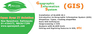
Program Content includes:
Basics of GIS
Fundamentals of Geography
Hardware and Software necessity
Basics of Geographic Information system & Mapping
Data Visualizations
Thematic Map Preparations
Ideas of RS
Fundamentals of Remote Sensing
Electromagnetic Energies
Basics of Global Positioning Systems
Basics of Photogrammetry
No comments:
Post a Comment