Wednesday, May 31, 2017

GIS Training in Kathmandu Nepal

GIS Training in Kathmandu Nepal
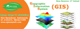
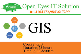
 Open Eyes IT Solution is running the classes of GIS with the name of GIS Training in Kathmandu Nepal in morning and day shift.

This program in Geographic Information Systems & Remote Sensing has become main technological tool for the collections, storages & examination of spatially referenced data. Industries utilizing these spatial technology which includes agriculture, forestry, mining, market research, environmental examination as well as the social & medical science.

This program also permits students to improve their knowledge & practical proficiency in GIS & RS technologies & applications.

The program content includes the subjects, which offers significant flexibility that allows students to speedily profit the GIS & RS knowledge & qualifications they need today, & to add to their qualifications at a later date if needed. Students develop ability for independently research, problems study & solutions.

Student will develops their skill & understanding through formal course works. By problem solving, examination & research skill improve by examination and the conclusion of a literature reviews.
For this program the least qualification necessary is that student should be a science graduate, PG from MSc with geography, geology, agriculture, forestry, Engineers in all stream.
Program content includes:

1) Principle of GIS
Under this unit all the required topics of Geographic Information Systems is covered. Students increase the fundamental theory, technical & analytical skill essential to apply Geographic Information Systems to simply spatial problem. The subject includes a important elements of practical works in which student are optimistic to directly apply their theoretical knowledge. Concentration is focused on the operation of Geographic Information Systems & the applications of Geographic Information Systems to easy spatial analysis. This subject form a basis for further study in other modules.

2) Images Analysis 
The subject covers the theoretical background of remote sensing; treats in detail the acquisition of digital data by imaging/non-imaging systems; and examines the commonly used procedures for enhancing and classifying multi spectral data.
GIS Training in Kathmandu Nepal
3) GIS Application
This subject extends the study of Geographic Information Systems. It expands advanced knowledge in the complex modeling of spatial data. Subject modules includes:
1. SQL base spatial queries
2. Selected advance analysis
3. Rasters analysis

The subjects extend the student theory & analytical capability. The practical constituent forms an essential part in developing the essential skills in GIS modeling.

4) Cartography and Data Visualization 
This topic introduces the student to the methods for the arrangement of spatial, numerical and table based data in order to maximize their efficiency and make simpler their understanding. Students will learn, geo coding, designing visualisation of informations, problems of human perception, variations in audience type, and the media or presentation environment selected.

5) Integrated Remote Sensing and GIS
This topic focuses on the integrations of geographic information systems & RS methodologies.The students will experience of various methods of land usage classifications, preparations of GIS thematic maps, perform change detection analysis.

GIS Training in Kathmandu Nepal
6) Algorithms in GIS Modelling
Provides an introduction to and overview of the application of statistical methods in spatial data analysis. The basic approach used will be to bring in light the practical faiths of using modern methods instead of previous compromises.

7) Remote Sensing Algorithm
This topics goal to give students an understanding of thesignificant mathematical ideas & algorithm usually used in processing, multispectral satellite imagery.


The main aim of the program is to make student capable of for positions in any reputed multinational Companies or geographic information systems or Remote Sensing companies. Student will be given coverage to all latest or geographic information systems or Remote Sensing technology during their program periods, which will helps students to reach their career goal.
Tuesday, May 30, 2017

GIS Training in Kathmandu Nepal

GIS Training in Kathmandu Nepal
Open Eyes IT Solution is running GIS Classes with the name of GIS Training in Kathmandu Nepal in Morning and Evening Shift. Hurry Up Book our Seat now.
Course details:
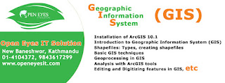
1. Installation of ArcGIS 10.1
2.Introduction to Geographic Information System (GIS)

  • General Overview of Geographic Information System
  • General Overview of Primary Components of Geographic information System
  • GIS Data types: Vector and Raster


GIS Training in Kathmandu Nepal
 3. Introduction to Geographic Information System(GIS)

  • Overview of the user interface/working environment of ArcCatalog
  • Overview of the user interface/working environment of ArcMap and ArcScence
  • General Map 
  • General Map Analysis

4.Shapefiles: Types , Creatining Shapefiles
5.Basic GIS Techniques

  • Viewing data,classfying features
  • Introduction to tables, working with tables
  • Changing the table display editing values and adding fields
  • Joining tables, Linking tables,Summerizing
  • Layer symbology, Labeling 

6.Geoprocessing in GIS
7. Analysis with ArcGIS Tools
Building queries, selecting features in a set of features, shapefiles Based on location and / or Attributes

  • working  in layout view
  • Printing maps

GIS Training in Kathmandu Nepal
8. Editing and digitizing in features in GIS

  • Editing Features
  • Digitizing Scanned maps 
  • Working with attributes tables
  • Exporting data to MSExcel
  • Making a topographical map

9. Use if Arcscan tool to digitize Scanned maps
10.Georeferencing

  • GeneralConcept of georeferencing 
  • Geo Referencing of Scanned maps to a set of known coordinate points

11. 3-D Analysis in GIS

  • Introduction to DEM, TIN Surface
  • General concept of 3D Analysis
  • ArcMap tools for 3D Analysis
  • Exercise on 3D Analysis

12. Simple Analysis Using GIS
GIS Training in Kathmandu Nepal
13.Hydrological Analysis using GIS

  • Use of hydrology toolbar
  • Watershed Delineation
  • Area and volume of Reservoirs

14.Spatial Analysis

  • Use of Model Builder

15. Data interoperability

  • Importing /Exporting Data to and from different sources/formats


Monday, May 29, 2017

GIS Training in Kathmandu Nepal

GIS Training in Kathmandu Nepal
Open Eyes IT Solution is running the classes on GIS with the name GIS Training in Kathmandu Nepal.This program in Geographic Information Systems & Remote Sensing has become main technological tool for the collections, storages & examination of spatially referenced data. Industries utilizing these spatial technology which includes agriculture, forestry, mining, market research, environmental examination as well as the social & medical science.

This program also permits students to improve their knowledge & practical proficiency in GIS & RS technologies & applications.

The program content includes the subjects, which offers significant flexibility that allows students to speedily profit the GIS & RS knowledge & qualifications they need today, & to add to their qualifications at a later date if needed. Students develop ability for independently research, problems study & solutions.
GIS Training in Kathmandu Nepal

Student will develops their skill & understanding through formal course works. By problem solving, examination & research skill improve by examination and the conclusion of a literature reviews.
For this program the least qualification necessary is that student should be a science graduate, PG from MSc with geography, geology, agriculture, forestry, Engineers in all stream.

Program content includes:

1) Principle of GIS

This program is planned for those who are: Executive or Teaching expert from diverse stream wanting to know about geographic information systems, Student who has done their graduation or they are undergrads and Software proficient planning to code on geographic information system Platform. This program includes twenty hours theoretical & twenty hours practical sessions.
GIS Training in Kathmandu Nepal

Program Content includes:

Basics of GIS
Fundamentals of Geography
Hardware and Software necessity
Basics of Geographic Information system & Mapping
Data Visualizations
Thematic Map Preparations
Ideas of RS
Fundamentals of Remote Sensing
Electromagnetic Energies
Basics of Global Positioning Systems
Basics of Photogrammetry

Sunday, May 28, 2017

GIS Training in Kathmandu Nepal

GIS Training in kathmandu Nepal

Open Eyes IT Solution is running GIS classes with the name of GIS Training in Kathmandu Nepal in Morning and Evining shift hurry up enroll now seat are limited.

I.Introducing GIS

What is GIS
What GIS can do
Types of GIS projects
Remote sensing, GPS, SDSS
II.ArcGIS

GIS Training in Kathmandu Nepal
Exploring ArcGIS
Spatial Data
Metadata
ArcCatalog
ArcToolbox
III. Working with ArcMap
GIS Training in kathmandu Nepal

Map documents
Windows and Menus
Help system GIS 111: August 2013
Data frames
Layers
Symbols and styles
Map scales and labeling
GIS Training in Kathmandu Nepal
IV.Coordinate Systems and Map Projection s

Map projections and GIS
Coordinate Systems
Spheroids and datums
Common projection systems
Projecting data

GIS Training in kathmandu Nepal


V.Drawing and Symbolizing Features

Types of maps
Classifying numeric data
Using map layers
Editing symbols and using styles
Displaying rasters
VI.Working with Tables

GIS Training in Kathmandu
Tables
Joining tables
Statistics
Summarizing tables
Editing and calculating tables
 VII. Queries

What are queries?
Selecting
Using queries in GIS analysis
GIS Training in Kathmandu Nepal
VIII. Spatial Joins

Spatial join
Types of joins
Setting up a spatial join
IX.Map Overlay

Map overlay
Other spatial analysis functions
Coordinate systems and map units
X.Presenting Data

Maps and Reports in ArcGIS
Working with map elements
Layout toolbar
Working with map scales
Setting up scale bars
XI.Geocoding

Introduction to geocoding
Geocoding styles
Geocoding process
Setting up the address locater GIS 111: August 2013
Reference data
x-y coordinates
 XII. Basic Editing in ArcMap

GIS Training in Kathmandu Nepal
Editing overview
The Editor Toolbar
Snapping features
Creating adjacent polygons
Editing features
Editing attributes
Saving work
XIII. Advanced Editing
GIS Training in kathmandu Nepal

Using sketch tools
Changing existing features
Combining features
Buffering features
Topology and shared features
 XIV. Working with Geodatabases

About geodatabases
Creating geodatabases
Creating feature datasets
Using default values
Setting up domains
f)Split and merge
Subtypes

Saturday, May 27, 2017

GIS Training in Kathmandu Nepal

GIS Training in Kathmandu Nepal
Open Eyes IT Solution is running the classes of GIS with the name of GIS Training in Kathmandu Nepal in morning and day shift.

This program in Geographic Information Systems & Remote Sensing has become main technological tool for the collections, storages & examination of spatially referenced data. Industries utilizing these spatial technology which includes agriculture, forestry, mining, market research, environmental examination as well as the social & medical science.

This program also permits students to improve their knowledge & practical proficiency in GIS & RS technologies & applications.
GIS Training in Kathmandu Nepal
The program content includes the subjects, which offers significant flexibility that allows students to speedily profit the GIS & RS knowledge & qualifications they need today, & to add to their qualifications at a later date if needed. Students develop ability for independently research, problems study & solutions.

Student will develops their skill & understanding through formal course works. By problem solving, examination & research skill improve by examination and the conclusion of a literature reviews.
For this program the least qualification necessary is that student should be a science graduate, PG from MSc with geography, geology, agriculture, forestry, Engineers in all stream.
Program content includes:

1) Principle of GIS
Under this unit all the required topics of Geographic Information Systems is covered. Students increase the fundamental theory, technical & analytical skill essential to apply Geographic Information Systems to simply spatial problem. The subject includes a important elements of practical works in which student are optimistic to directly apply their theoretical knowledge. Concentration is focused on the operation of Geographic Information Systems & the applications of Geographic Information Systems to easy spatial analysis. This subject form a basis for further study in other modules.
GIS Training in Kathmandu Nepal
2) Images Analysis 
The subject covers the theoretical background of remote sensing; treats in detail the acquisition of digital data by imaging/non-imaging systems; and examines the commonly used procedures for enhancing and classifying multi spectral data.

3) GIS Application
This subject extends the study of Geographic Information Systems. It expands advanced knowledge in the complex modeling of spatial data. Subject modules includes:
1. SQL base spatial queries
2. Selected advance analysis
3. Rasters analysis

The subjects extend the student theory & analytical capability. The practical constituent forms an essential part in developing the essential skills in GIS modeling.

4) Cartography and Data Visualization 
This topic introduces the student to the methods for the arrangement of spatial, numerical and table based data in order to maximize their efficiency and make simpler their understanding. Students will learn, geo coding, designing visualisation of informations, problems of human perception, variations in audience type, and the media or presentation environment selected.

5) Integrated Remote Sensing and GIS
This topic focuses on the integrations of geographic information systems & RS methodologies.The students will experience of various methods of land usage classifications, preparations of GIS thematic maps, perform change detection analysis.
GIS Training in Kathmandu Nepal
6) Algorithms in GIS Modelling
Provides an introduction to and overview of the application of statistical methods in spatial data analysis. The basic approach used will be to bring in light the practical faiths of using modern methods instead of previous compromises.

7) Remote Sensing Algorithm
This topics goal to give students an understanding of thesignificant mathematical ideas & algorithm usually used in processing, multispectral satellite imagery.

The main aim of the program is to make student capable of for positions in any reputed multinational Companies or geographic information systems or Remote Sensing companies. Student will be given coverage to all latest or geographic information systems or Remote Sensing technology during their program periods, which will helps students to reach their career goal.


GIS Training in Kathmandu Nepal

GIS Training in Kathmandu Nepal
Geographic information systems (GIS) play a major role in managing resources and facilitating effective management decisions. GIS data capture systems can be used to map and track natural resources, maintain and update complex equipment inventories or urban assets, and many other tasks. The use of GIS has gone beyond the traditional boundary of defense infrastructure, utility services and land record management. It is now being increasingly recognized worldwide as an important tool for business intelligence and personal utility.

The Geographic Information Technology curriculum at Open Eyes IT Solution provides a broad background in Geographic Information Systems (GIS Training in Kathmandu Nepal) technologies with practical applications in municipal, industrial, natural resources, management, and other fields. The GIS specialists utilize powerful computer hardware and software to collect, store, retrieve, process and present geographic information.
GIS Training in Kathmandu Nepal

Geographic information technologies have an unmatched effect on the entire spectrum of knowledge by targeting the spatial information about “what is where” on Earth's surface and making decisions easy by representing the information in a digital format which can be edited, sampled and updated in a user friendly environment. 

Open Eyes IT Solution aims at imparting state-of-the-art education and training in GIS to fulfill the continued requirements of professionals in the field of GIS. Institute of Geoinformatics & Remote Sensing develops technical capabilities through long-term and short term training programmes, workshops, orientation programmes and customized thematic programmes in GIS.

Open Eyes IT Solution offers courses of two to six months in different disciplines of geographic information technologies, such as Introduction to GIS and RS, Photogrammetry, Spatial Analysis, Geostatistics, GIS Project Development, WebGIS and Geodatabases. Open Eyes IT Solution also provides customized training programs to different organizations. 
GIS Training in Kathmandu Nepal

The GIS courses offered by Open Eyes IT Solution are taught by a highly qualified and experienced Instructor. The courses provide the foundation for becoming a successful user of the technology. Expert short lectures followed by hands-on tutorial sessions using the latest version of the ArcGIS software on the computers provided for each attendee. The course includes a certificate of completion.


Objectives

  • To conduct intensive training programs in GIS for providing hands-on training capabilities to professionals in public and private sector.

  
  • To offer comprehensive Post Graduate Diploma and Certification course in the fields of Remote Sensing and Geographical Information Systems.


  • To assist in GIS-related strategic planning, development and implementation of GIS policies and standards at national level.


  • To build expertise in geo-relational software product development through applied research in GI Sciences and their applications.


To provide research or consultancy on areas identified by public and private organizations.


Training Programme

Geoinformatices courses offered by Open Eyes IT Soluton are designed to cater all section of trainees, student to professionals from different educational and professional sectors. 

The courses offered by Open Eyes IT Solution will educate the trainees to:

  • Gain a knowledge and understanding of the technology, terminology, potential and capacity of GIS as a means of modeling the world;
  • An appreciation of the relationship between GIS and other chosen subjects;
  • An ability to apply GIS to the practical solutions of problems;
  • Acquire a range of transferable skills such as project management, client interaction, project interpretation, and project problem solving.

An in depth picture of the present career opportunities.

GIS Training in Kathmandu Nepal

Objectives of the course

  • Provide enough knowledge and understanding of GIS to face the GIS world.
  • To provide an intensive educational opportunity designed to equip students for either a career in the Geographical Information industry or for further research.
  • To develop detailed knowledge and understanding of recent advances in computing technology and software engineering methods, which are relevant to GIS applications.

To develop abilities in assimilating and communicating material of a technical kind.

Thursday, May 25, 2017

GIS Training in Kathmandu Nepal

GIS Training in Kathmandu Nepal
The student of this program should have the fundamental knowledge of GIS. This After completing this program student enable to acquire various objectives of the course like:

· Executing fundamentals of GIS operation using QGIS
· Displaying, editing & Query GIS data usage of QGIS
· Georeference raster Image
· Works with different QGIS Plugin
· Works with GRASS Plugin to do fundamental of GIS operation
· Building Topology & Cleaning of Topology error using GRASS Plugins
· Executing Spatial examination function using GRASS Plugins

Program covers the topics like:
· Introductions to QGIS
· Installations
· Display Data
· Creates and Edits Data
· Query Data
· Introductions to Plugin
· Georeferencing
· Introductions to GRASS Plugin
· Creates and Edits Data by using GRASS
· Construction Topology in GRASS
· Spatial examination using GRASS

Monday, May 22, 2017

GIS Training in Baneshwor Kathmandu Nepal

GIS Training in Kathmandu Nepal
Geospatial technology is increasingly applied in organizations today to harness location advantages and to address operational, regulatory, and service needs.
Open Eyes IT Solution recognizes the power of geospatial technology and strongly believes that Geographic Information System (GIS Training in Kathmandu Nepal) benefits must permeate all industries and organizations, enabling businesses across verticals to make informed, location-specific decisions. In an effort to turn this vision into reality, we have continually serviced the needs of global GIS markets through our focused, innovative, and efficient services in all areas of spatial technology and applications.

We globally serve the following industries with our quality products and committed services:

Utilities
Land Records
Transportation
Key Features

GIS Consulting and Solution Implementation

Perform assessment
Define application/data migration strategy and GIS enterprise solution strategy
Provide onshore/offshore business consultancy
Evaluate existing technology landscape and environment, and assist in the application of GIS technology
Support the implementation of geospatial solutions such as municipal GIS solutions, spatial data infrastructure, intelligent maps solutions, geo-portals, parcel fabric, smart grid and utilities, cloud solutions, and mobile GIS
GIS Application Development and Management
GIS Training in Kathmandu Nepal

Design and develop customized GIS solutions on desktop, Web, and mobile platforms
Manage integration of GIS with existing IT systems
Achieve version/platform migration for the existing applications
Offer GIS third-party services
Offer Technology expertise in multiple development programming interfaces
GIS Data Development and Implementation

Aerial and satellite mapping to generate maps
Expertise in geodatabase modeling and management
Geospatial database management, including spatial data modeling, migration, and versioning of geospatial data
Capability to provide complete range of photogrammetric services
Light Detection and Ranging (LiDAR) and 3D modeling

Sunday, May 21, 2017

GIS Training in Kathmandu Nepal

GIS Training in Kathmandu Nepal

Open Eyes IT Solution provides educative and professional GIS Training in Kathmandu Nepal and Remote Sensing. Courses are designed to keep you on top of the rapidly evolving and increasingly technical nature of Geomatics. We offer classroom training.
GIS Training in Kathmandu Nepal

Courses are designed such that each participant gets more than 50% of the time to work with the tools. Lectures are also interactive encouraging the participants to start working with their own data on their own projects. Our course offerings are supported by domain specific data and our in house domain experts are accessible to the participants for their queries.
GIS Training in Kathmandu Nepal

We offer the following courses individually or as combination depending on needs of the participants.

Introduction to GIS and Remote Sensing
Quantum GIS: Basics and Advanced topics
Developing Customized GIS applications using Quantum GIS
GRASS: A tool for advanced analysis
WebGIS using Geoserver
PostGIS: Using Spatial DB for Analysis
WebGIS using MapServer
WebGIS using PHP/MapScript
Introduction to Open Layers
Introduction to Geospatial Libraries

Thursday, May 18, 2017

GIS Training in Baneshwor Kathmandu Nepal

GIS Training in Kathmandu Nepal
 ArcGIS is a complete platform that individuals and organizations use to find, explore, create, and share maps; apply geospatial data, tools, and models to solve problems; collaborate in groups and communities; and deploy geospatial resources whenever and wherever they are needed.

The latest release of ArcGIS transforms how geographic information will be accessed and managed by geographic information system (GIS) professionals, like yourself, and organizations. GIS professionals can now benefit from complete web GIS that integrates desktops and servers as well as mobile and web applications and includes additional tools and infrastructure needed to extend the reach of your existing GIS.

GIS Training in Kathmandu Nepal

Training for Organizations

Your teams execute day-to-day operations, engage with customers and constituents, and create products and services that give you a competitive advantage. Equip them with the Esri technology skills they need to achieve your strategic goals.

We partner with organizations to:

Provide course recommendations for individual roles.
Create focused training plans to support upcoming projects.
Craft staff development plans tailored to your location strategy and ArcGIS-enabled workflows.


Wednesday, May 17, 2017

GIS Training in Kathmandu Nepal

GIS Training in Kathmandu Nepal
A geographic information system (GIS) integrates hardware, software, and data for capturing, managing, analyzing, and displaying all forms of geographically referenced information. GIS have become a tool with widespread use in developmental applications. The power of a GIS can have a positive influence in community based planning and scientific decision making for developmental activities. In this class, you will learn about basic GIS concepts including spatial data structures, data sources and transfer methods, projections and coordinate systems, geo-referencing, metadata, supporting software, global positioning systems, the integration of remote sensing and GIS, as well as fundamental spatial analysis techniques such as overlay, extraction, and interpolation. Concepts presented in lecture will be put into practice through hands-on laboratory exercises utilizing the GIS software product like: ArcGIS, AutoCAD Map, Quantum GIS, GRASS and ERDAS
GIS Training in Kathmandu Nepal
GIS Training in Kathmandu  Nepal

Thursday, May 4, 2017

GIS Training in Kathmandu Nepal || Open Eyes IT Solution

GIS Training in Kathmandu Nepal|| Open Eyes IT Solution

Open Eyes IT Solution is one of the finest Computer Training Institute in Baneshwor Kathmandu, Nepal. It offers professional training in Programming Languages especially for those who have Bachelor's Degree in IT and looking forward to develop career in Software Development or Web Development Technology.
GIS Training in Kathmandu Nepal|| Open Eyes IT Solution

A geographic information system (GIS) is a powerful tool for displaying, exploring, and analyzing
geographic data. Any data that has a geographic component (including most data in the Earth sciences and environmental sciences) can benefit from GIS. Formerly a tool employed primarily by city planners, conservationists, utilities, and developers, GIS is becoming increasingly ubiquitous in geology and even in non-traditional fields such as the social sciences. Familiarity with GIS can be a decided advantage in today’s job market.
GIS Training in Kathmandu Nepal|| Open Eyes IT Solution

Course objectives:

* Learn how geographic data is created, stored,      projected, and analyzed
* Become proficient with ArcGIS 9 software
* Understand how to answer questions about           spatial relationships using GIS
* Use GIS concepts to advance your own                 research

Wednesday, May 3, 2017

GIS Training in Baneshwor Kathmandu Nepal

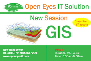
Open Eyes IT Solution Announce New Session on GIS Training in Kathmandu Nepal from  1st Jestha 2074.  Hurry Up Seat are Limited. Our Expert Can Make you one. Further more details call us now 977-14104372, 977-9843617299. Or visit our website: http://openeyes.com.np/ and our mailing address: info@openeyesit.com .