Sunday, June 11, 2017

GIS Training in Kathmandu Nepal


GIS Training in Kathmandu Nepal
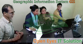
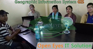
Open Eyes IT Solution is going to start new session on GIS Training in Kathmandu Nepal. Here you will get chance to learn GIS System from basic to advance in a friendly environment. Hurry uo seat are limited Enroll now. Further more details call us 977-1-4104372, 977-9843617299.

Geographic Information Systems (GIS) are software and hardware systems that enable the creation, management, analysis, and display of geographical data. These facilities combines both digital maps and textual databases. Any profession and business that is spatial related such as architecture, engineering, urban planning, real estate, marketing, transport, environmental management, and surveying, can benefit from using GIS.

GIS Training in Kathmandu Nepal
The programmes are intended for full-time working practitioners in spatial-related disciplines. The programmes serve as an advancement option to enable practitioners in Kathmandu to enhance their GIS knowledge and use GIS effectively in their work. They also extend an excellent opportunity for people of all professions to constantly keep themselves abreast of the latest developments and to gain immediate insight to the utility of the techniques. Courses are offered on weekday evenings or on weekends to cater to the working class.

GIS Training in Kathmandu Nepal
Understanding how and when to apply ArcGIS tools and functions is the key to creating an efficient GIS workflow. Building on the skills and knowledge taught in ArcGIS Desktop II: Tools and Functionality, this course shows how to apply ArcGIS tools in a workflow context with a focus on working with data stored in a geodatabase and performing geoprocessing and analysis. In the course exercises, you organize and edit data stored in a geodatabase, prepare data for analysis, create and edit geoprocessing models using ModelBuilder, and work through a challenging analysis project.

Topics Covered
  • Getting data into the geodatabase: Advantages of migrating data to the geodatabase; File and personal geodatabases; Loading and importing data; Data sources available for conversion; ArcToolbox conversion tools; Importing and exporting data in ArcCatalog; Importing and exporting data using XML; Copying and pasting data between geodatabases; Batch and single conversions; Loading data into existing feature classes using the Simple Data Loader; Displaying x,y coordinate data from a table; Accessing tabular data using an OLE DB connection; Adding data from a GIS server; Working with map projections and datums.


    GIS Training in Kathmandu Nepal
    GIS Training in Kathmandu Nepal
  • Geodatabase behavior: What is behavior?; Advantages of using behaviors; Default values; Subtypes; Domains; Geodatabase topology.

  • Editing GIS data: Creating new data (digitizing, copying and pasting features, Editor menu commands); Constructing an edit sketch using constraints (direction, length, parallel); Creating adjacent polygons using the Auto-Complete Polygon task; Modifying existing features; Reshaping existing features and boundaries; Exploding multipart features; Editing using domains, subtypes, and topology.

  • Alligning spatial data: Common data alignment problems; Georeferencing CAD data; Matching layer boundaries; Transformation; Rubber sheeting; RMS error.

  • Managing geoprocessing tools and settings: Types of toolboxes and how they are stored; Types of tools (system tools, models, scripts); Locating tools in ArcToolbox; Executing tools; Tool parameters; Parameter error detection; Environment settings; Tool layers; Geoprocessing results.

GIS Training in Kathmandu Nepal
  • Analyzing GIS data: Review of common analysis tools (Buffer, Clip, Intersect, Select, Union); Working with feature proximity tools (Near, Spatial Join, Multiple Ring Buffer, Create Thiessen Polygons); Analyzing tabular data; Creating a raster subset; Analysis options outside of core ArcGIS Desktop; Typical analysis workflow.

  • Using ModelBuilder for analysis: Working with ModelBuilder; Creating and designing models; Model elements (tools and variables); Setting general model properties; Setting model parameters; Environment settings; Intermediate data; Running and troubleshooting a model; Creating model documentation.


Friday, June 9, 2017

GIS Training in Kathmandu Nepal

GIS Training in Kathmandu Nepal
Open Eyes IT Solution is going to start new session on GIS Training in Kathmandu Nepal.

Investigate the power of maps and spatial data to document and illustrate local and global issues. Learn how to use Geographic Information Systems (GIS) to explore the world around you and share ideas. Apply GIS principles and tools to create your own maps from freely-available online spatial data.

Discover the diverse uses of mapping, Geographic Information Systems (GIS) and spatial data, and how they underpin decision-making in every aspect of our lives. Explore and critically appraise maps to gain a better appreciation of the world around you. Learn how to use free open-source software (Quantum GIS) to import, display and analyse spatial data. Collect and integrate spatial data from a variety of sources. Experience realistic tasks in the context of international case studies, which range from resource management, wildlife conservation and leisure hiking to archaeology and disaster relief. Apply your learning to create maps which illustrate your own interests or hobbies, based on sound cartographic principles.
GIS Training in Kathmandu Nepal

1. What are spatial data and Geographic Information Systems?
Explore how maps and spatial analysis pervade our world, and consider the use of maps in the media. Install the GIS software and take your first steps in displaying spatial data.

2. Who uses spatial data, maps and GIS, and what for?
Consider how GIS is used in different industries and leisure activities. Encounter the power and versatility of maps and GIS to illustrate patterns, exploring osprey migration routes in a wildlife case study.
GIS Training in Kathmandu Nepal

3. Understanding spatial reference systems
Learn how to refer to the spatial location of objects on the earth’s surface, and understand how this translates to locations on a flat map. 

4. Representing spatial features
Grasp the difference between discrete spatial objects and continuous surfaces, and learn the characteristics of the two primary data formats (vector and raster) which represent them. 

5. Interpreting maps
Interpret the symbols, contours and scale on a topographic map, and learn how to navigate using a compass. 

6. Working with raster layers
Experience the power of remotely sensed imagery to visualize environmental patterns. 

7. Working with vector layers
Generate and edit your own vector data by hand-digitizing, and add non-geographic information to your new layers. Extend the Pakistan disaster relief case study by calculating the area affected by flooding.

GIS Training in Kathmandu Nepal
8. Introduction to symbology and cartography
Explore the art of cartography, and discuss how to communicate your message to a specific audience. 

9. Making maps
Learn how the key elements of a map (scale bar, legend, graticule) allow viewers to interpret your map and understand your message. 

10. Introduction to spatial analysis
Discover how the utility of GIS extends far beyond map-making. Explore concepts in spatial analysis that will allow you to create new data, identify patterns, and support future decision-making. 


Thursday, June 8, 2017

GIS Training in Kathmandu Nepal


GIS Training in Kathmandu Nepal
Geographic Information System (GIS) deals with the analysis and management of geographic information. This course offers an introduction to methods of managing and processing geographic information. Emphasis will be placed on the nature of geographic information, data models and structures for geographic information, geographic data input, data manipulation and data storage, spatial analytic and modeling techniques, and error analysis. The course is made of two components: lectures and labs. In the lectures, the conceptual elements of the above topics will be discussed. The labs are designed in such a way that students will gain first-hand experience in data input, data management, data analyses, and result presentation in a geographical information system. Students must be clear that this is not a class specifically on any particular GIS software. It is a course on the underlying theory and concepts in GIS. The understanding of these concepts and theories will help you to perform spatial analysis in a GIS system properly and efficiently
GIS Training in Kathmandu Nepal

Organizations use ArcGIS Online to facilitate collaboration and efficient access to maps and other GIS resources. This course shows how to publish data and map layers directly to ArcGIS Online as services, then use those services to quickly build a web map. You will also learn how to turn a web map into a web app to provide a focused experience for your audience. Access to an ArcGIS Online organizational account is needed to complete course exercises.

GIS Training in Kathmandu Nepal
Learn How To

Publish hosted feature services and tiled map services to ArcGIS Online.
Quickly create and configure a web map using the ArcGIS Online map viewer.
Use an ArcGIS Online template to easily share a web map as a web app.
Choose appropriate sharing levels to accommodate the intended users of a web map or web app.
Software Requirements

To complete course exercises, you need the following:

ArcGIS 10.2 for Desktop or ArcGIS 10.3 for Desktop (Basic, Standard, or Advanced)
ArcGIS Online Organizational Account
Publisher role or equivalent
Approximate number of service credits consumed: 5 (based on current service credit rates; rates subject to change)
GIS Training in Kathmandu Nepal
LEARNING OUTCOMES: Upon completion of this course, the student will be able to:

a) Define GIS

b) Use GIS to identify, explore, understand, and solve spatial problems

c) Demonstrate GIS modeling skills

d) Demonstrate critical thinking skills in solving geospatial problems.

e) Design and implement a GIS project

f) Demonstrate competency with the ArcMap software to enhance and interpret data

g) Use queries in GIS Analysis

h) Formulate applications of GIS technology.

OUTLINE OF INSTRUCTION

I.Introducing GIS

What is GIS
What GIS can do
Types of GIS projects
Remote sensing, GPS, SDSS

II.ArcGIS

Exploring ArcGIS
Spatial Data
Metadata
ArcCatalog
ArcToolbox

III. Working with ArcMap

Map documents
Windows and Menus
Help system GIS 111: August 2013
Data frames
Layers
Symbols and styles
Map scales and labeling
GIS Training in Kathmandu Nepal

IV.Coordinate Systems and Map Projection s

Map projections and GIS
Coordinate Systems
Spheroids and datums
Common projection systems
Projecting data


V.Drawing and Symbolizing Features

Types of maps
Classifying numeric data
Using map layers
Editing symbols and using styles
Displaying rasters

VI.Working with Tables

Tables
Joining tables
Statistics
Summarizing tables
Editing and calculating tables
 VII. Queries

What are queries?
Selecting
Using queries in GIS analysis

GIS Training in Kathmandu Nepal
VIII. Spatial Joins

Spatial join
Types of joins
Setting up a spatial join

IX.Map Overlay

Map overlay
Other spatial analysis functions
Coordinate systems and map units

X.Presenting Data

Maps and Reports in ArcGIS
Working with map elements
Layout toolbar
Working with map scales
Setting up scale bars

XI.Geocoding

Introduction to geocoding
Geocoding styles
Geocoding process
Setting up the address locater GIS 111: August 2013
Reference data
x-y coordinates
GIS Training in Kathmandu Nepal

 XII. Basic Editing in ArcMap

Editing overview
The Editor Toolbar
Snapping features
Creating adjacent polygons
Editing features
Editing attributes
Saving work

XIII. Advanced Editing

Using sketch tools
Changing existing features
Combining features
Buffering features
Topology and shared features

 XIV. Working with Geodatabases

About geodatabases
Creating geodatabases
Creating feature datasets
Using default values
Setting up domains
Split and merge
Subtypes



Wednesday, June 7, 2017

GIS Training in Kathmandu Nepal

GIS Training in Kathmandu Nepal
Attend GIS training in Kathmandu Nepal. Open Eyes IT Solution provides more than 150+ IT and Business training courses throughout Kathmandu, Nepal. Whether you're looking for customized onsite arcgis training for a private group throughout Kathmandu , Open Eyes IT Solution has the solution for you.

GIS Training in Kathmandu Nepal
We also Provide Private training.It is an excellent corporate solution to achieve maximum value for your training funds. Private group training is ideal for situations requiring more than 1 student taking the same training. Open Eyes IT Solution has been helping our clients achieve their private group training objectives since 2015. Our goal is to meet your learning requirements, with a strong focus on achieving excellence in all your interactions with us.
GIS Training in Kathmandu Nepal

We can deliver any classroom  course in a private format - at your facility, in Kathmandu Nepal.

GIS Training in Kathmandu Nepal
Since students in your group have similar goals, we can customize and streamline your training program, which means a more relevant education and often enables us to discount the training by 10-20% or more.

GIS Training in Kathmandu Nepal
Discover your exact savings with a Free Private Training Consultation today! Your dedicated Open Eyes IT Solution will determine your needs, answer your questions and present you with a complimentary quote for your private training program.


Tuesday, June 6, 2017

GIS Training in Kathmandu Nepal

GIS Training in Kathmandu Nepal
Open Eyes IT Solution GIS training in Kathmandu Nepal programs aims to give a strong theoretical foundation and excellent hands-on skills to prepare participants explore careers in and meet the challenges of the GIS world

Find, explore, and create maps using GIS.

GIS Training in Kathmandu Nepal
  • Help students visualize and query the spatial data and attribute data and make connections to their own environment.
  • Present questions and have students explore GIS maps to find answers.
  • Guide students through a standard process for investigating a problem using GIS.
  • Prepare a GIS map presentation on a topic of interest.
  • Prepare a Layout of the map for the AOI.
  • Connecting to geospatial data over the internet.
  • Working with geodatabase.
  • How to work with attribute data.
  • Displaying, symbolizing and classifying geospatial datasets.
  • Creating maps for printing.
  • How to perform attribute and spatial data queries.
  • How to perform spatial analyses.
  • On-screen digitizing of map data; importing coordinates.
  • Metadata - what it is and why you need to know about it and create it.

GIS Training in Kathmandu Nepal

After successfully completing this course, you will have acquired an understanding of general GIS terms and the basic functionality of GIS software suite. 

Quickly create and Edit a GIS Map.
Find and organize geographic data and other GIS resourses for a mapping project.
Accurately display features on a GIS map and efficiently access information about them.
Analyze a GIS map to identify where features that meet specific criteria are located.
Create GIS maps and analyze results so they can be viewed using desktop applications.

GIS Training in Kathmandu Nepal

Course Overview

  • Explore conceptual foundations of spatial information systems.
  • Review cartographic and data visualization techniques.
  • Examine several types of geospatial data and spatial information systems.
  • Address the needs of the Spatial Analysis of the maps.
  • What is the GIS System?
  • GIS Basics
  • What are the essentials of GIS?
  • Mapping real-world feature locations using coordinate systems.
  • Finding GIS maps and data
  • Exploring a GIS maps.
  • GIS analysis
  • Create Map Layout.

GIS Training in Kathmandu Nepal

Pre-requisites

  • Any person with passion and who wants a career in GIS can opt for GIS Course.
  • Minimum Computer Knowledge with any qualification.
  • Should be a graduate.
  • A fresher, who is looking to make his career in GIS analysis.
  • An Experienced Professional who wishes to switch over to GIS Development.
  • Any GIS Professional who wishes to improve his/her skills.


Desired Candidate Profile

  • Any Graduate with Good grasping skills.
  • Good Communication & Presentation Skills.
  • Self-Starter, Problem Solver, Strong Analytical Skills.


Monday, June 5, 2017

GIS Training in Kathmandu Nepal

GIS Training in Kathmandu Nepal
Open Eyes IT Solution is going to start new session on GIS Training in Kathmandu Nepal. Our course overviews are as mention below:

Foundation

Mapping Essentials
GIS Essentials
Data Sources for GIS
Introduction to Web GIS Platform
Components of Desktop GIS
GIS Training in Kathmandu Nepal

Basic

Display Feature and Tabular data
Work with Georeferenced Spatial Data
Querying Features using Logical Expressions
Find Features using Spatial Relationships
Editing spatial data -Creating Features

GIS Training in Kathmandu Nepal
Intermediate

Edit attribute data - Creating a Base Map
Integrating CAD Data with GIS
Associate Tables with Joins and Relates
Produce Maps, Reports, and Graphs
Manage Geographic data

GIS Training in Kathmandu Nepal
Advanced

Perform Geocoding
Automated Vectorization
Creating Vector Data on Google Earth
Convert data from other formats
Parcel Editing
GIS Training in Kathmandu Nepal

Implementation

Perform spatial analysis
Create and Use Metadata
Real time Project
Getting Started with Web GIS


Sunday, June 4, 2017

GIS Training in Kathmandu Nepal

GIS Training in Kathmandu Nepal
This course provides an overview of the theoretical and practical foundations of the applied use of Geographic Information Systems (GIS). At the end of the course, you will have a working knowledge of GIS and how to apply these systems in various situations and organizational settings.

GIS Training in Kathmandu Nepal
This course will introduce you to the design and development of basic GIS applications and systems. Utilizing knowledge gained in core GIS courses; you will develop the fundamental components of a GIS solution.

GIS Training in Kathmandu Nepal
This course teaches what a GIS is and what you can do with it. Working with various components of the GIS system, you will create GIS maps, explore and analyze the data behind the maps, and apply methods to analyze your maps.

GIS Training in Kathmandu Nepal
By the end of the course, you will have a solid understanding of how GIS maps and GIS tools are used to visualize real-world features, discover patterns, obtain information, and communicate that information to others.

Open Eyes IT Solution has designed “GIS – Data Development Course” for people with an interest in the use of applications of geospatial technologies (GIS, remote sensing) to environmental and social change issues. 

GIS Training in Kathmandu Nepal
Open Eyes IT Solution Trainees will learn not only the tools of spatial analysis, but also will learn how to apply these tools to real life problems in the course of seeking solutions. The course of study is designed to accommodate both GIS novices and people with previous GIS experience.