 |
| GIS Training in Kathmandu Nepal |
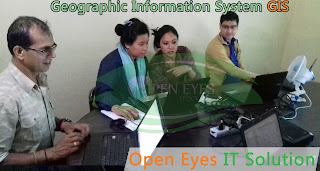
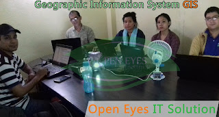
Open Eyes IT Solution GIS training in Kathmandu Nepal programs aims to give a strong theoretical foundation and excellent hands-on skills to prepare participants explore careers in and meet the challenges of the GIS world
Find, explore, and create maps using GIS.
 |
| GIS Training in Kathmandu Nepal |
- Help students visualize and query the spatial data and attribute data and make connections to their own environment.
- Present questions and have students explore GIS maps to find answers.
- Guide students through a standard process for investigating a problem using GIS.
- Prepare a GIS map presentation on a topic of interest.
- Prepare a Layout of the map for the AOI.
- Connecting to geospatial data over the internet.
- Working with geodatabase.
- How to work with attribute data.
- Displaying, symbolizing and classifying geospatial datasets.
- Creating maps for printing.
- How to perform attribute and spatial data queries.
- How to perform spatial analyses.
- On-screen digitizing of map data; importing coordinates.
- Metadata - what it is and why you need to know about it and create it.
 |
| GIS Training in Kathmandu Nepal |
After successfully completing this course, you will have acquired an understanding of general GIS terms and the basic functionality of GIS software suite.
Quickly create and Edit a GIS Map.
Find and organize geographic data and other GIS resourses for a mapping project.
Accurately display features on a GIS map and efficiently access information about them.
Analyze a GIS map to identify where features that meet specific criteria are located.
Create GIS maps and analyze results so they can be viewed using desktop applications.
 |
| GIS Training in Kathmandu Nepal |
Course Overview
- Explore conceptual foundations of spatial information systems.
- Review cartographic and data visualization techniques.
- Examine several types of geospatial data and spatial information systems.
- Address the needs of the Spatial Analysis of the maps.
- What is the GIS System?
- GIS Basics
- What are the essentials of GIS?
- Mapping real-world feature locations using coordinate systems.
- Finding GIS maps and data
- Exploring a GIS maps.
- GIS analysis
- Create Map Layout.
 |
| GIS Training in Kathmandu Nepal |
Pre-requisites
- Any person with passion and who wants a career in GIS can opt for GIS Course.
- Minimum Computer Knowledge with any qualification.
- Should be a graduate.
- A fresher, who is looking to make his career in GIS analysis.
- An Experienced Professional who wishes to switch over to GIS Development.
- Any GIS Professional who wishes to improve his/her skills.
Desired Candidate Profile
- Any Graduate with Good grasping skills.
- Good Communication & Presentation Skills.
- Self-Starter, Problem Solver, Strong Analytical Skills.
No comments:
Post a Comment