Monday, May 22, 2017

GIS Training in Baneshwor Kathmandu Nepal

GIS Training in Kathmandu Nepal
Geospatial technology is increasingly applied in organizations today to harness location advantages and to address operational, regulatory, and service needs.
Open Eyes IT Solution recognizes the power of geospatial technology and strongly believes that Geographic Information System (GIS Training in Kathmandu Nepal) benefits must permeate all industries and organizations, enabling businesses across verticals to make informed, location-specific decisions. In an effort to turn this vision into reality, we have continually serviced the needs of global GIS markets through our focused, innovative, and efficient services in all areas of spatial technology and applications.

We globally serve the following industries with our quality products and committed services:

Utilities
Land Records
Transportation
Key Features

GIS Consulting and Solution Implementation

Perform assessment
Define application/data migration strategy and GIS enterprise solution strategy
Provide onshore/offshore business consultancy
Evaluate existing technology landscape and environment, and assist in the application of GIS technology
Support the implementation of geospatial solutions such as municipal GIS solutions, spatial data infrastructure, intelligent maps solutions, geo-portals, parcel fabric, smart grid and utilities, cloud solutions, and mobile GIS
GIS Application Development and Management
GIS Training in Kathmandu Nepal

Design and develop customized GIS solutions on desktop, Web, and mobile platforms
Manage integration of GIS with existing IT systems
Achieve version/platform migration for the existing applications
Offer GIS third-party services
Offer Technology expertise in multiple development programming interfaces
GIS Data Development and Implementation

Aerial and satellite mapping to generate maps
Expertise in geodatabase modeling and management
Geospatial database management, including spatial data modeling, migration, and versioning of geospatial data
Capability to provide complete range of photogrammetric services
Light Detection and Ranging (LiDAR) and 3D modeling

Sunday, May 21, 2017

GIS Training in Kathmandu Nepal

GIS Training in Kathmandu Nepal

Open Eyes IT Solution provides educative and professional GIS Training in Kathmandu Nepal and Remote Sensing. Courses are designed to keep you on top of the rapidly evolving and increasingly technical nature of Geomatics. We offer classroom training.
GIS Training in Kathmandu Nepal

Courses are designed such that each participant gets more than 50% of the time to work with the tools. Lectures are also interactive encouraging the participants to start working with their own data on their own projects. Our course offerings are supported by domain specific data and our in house domain experts are accessible to the participants for their queries.
GIS Training in Kathmandu Nepal

We offer the following courses individually or as combination depending on needs of the participants.

Introduction to GIS and Remote Sensing
Quantum GIS: Basics and Advanced topics
Developing Customized GIS applications using Quantum GIS
GRASS: A tool for advanced analysis
WebGIS using Geoserver
PostGIS: Using Spatial DB for Analysis
WebGIS using MapServer
WebGIS using PHP/MapScript
Introduction to Open Layers
Introduction to Geospatial Libraries

Thursday, May 18, 2017

GIS Training in Baneshwor Kathmandu Nepal

GIS Training in Kathmandu Nepal
 ArcGIS is a complete platform that individuals and organizations use to find, explore, create, and share maps; apply geospatial data, tools, and models to solve problems; collaborate in groups and communities; and deploy geospatial resources whenever and wherever they are needed.

The latest release of ArcGIS transforms how geographic information will be accessed and managed by geographic information system (GIS) professionals, like yourself, and organizations. GIS professionals can now benefit from complete web GIS that integrates desktops and servers as well as mobile and web applications and includes additional tools and infrastructure needed to extend the reach of your existing GIS.

GIS Training in Kathmandu Nepal

Training for Organizations

Your teams execute day-to-day operations, engage with customers and constituents, and create products and services that give you a competitive advantage. Equip them with the Esri technology skills they need to achieve your strategic goals.

We partner with organizations to:

Provide course recommendations for individual roles.
Create focused training plans to support upcoming projects.
Craft staff development plans tailored to your location strategy and ArcGIS-enabled workflows.


Wednesday, May 17, 2017

GIS Training in Kathmandu Nepal

GIS Training in Kathmandu Nepal
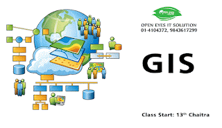
A geographic information system (GIS) integrates hardware, software, and data for capturing, managing, analyzing, and displaying all forms of geographically referenced information. GIS have become a tool with widespread use in developmental applications. The power of a GIS can have a positive influence in community based planning and scientific decision making for developmental activities. In this class, you will learn about basic GIS concepts including spatial data structures, data sources and transfer methods, projections and coordinate systems, geo-referencing, metadata, supporting software, global positioning systems, the integration of remote sensing and GIS, as well as fundamental spatial analysis techniques such as overlay, extraction, and interpolation. Concepts presented in lecture will be put into practice through hands-on laboratory exercises utilizing the GIS software product like: ArcGIS, AutoCAD Map, Quantum GIS, GRASS and ERDAS
GIS Training in Kathmandu Nepal
GIS Training in Kathmandu  Nepal